|

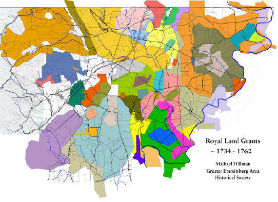
If you click on the map, a much larger
version - 2' x 1', will be downloaded. Because of its size, it
will take a few moments to download. If you find the map useful,
please consider:
-
joining join us
at our next monthly meeting,
-
sending us a
worthy addition for our history articles archives about a
relative who once called Emmitsburg home;
-
or send us your own memories
about life in Emmitsburg.
We are one
third through our goal of identifying all the landholders since the original
royal land grants. Once we are done, will produced maps showing the
changes of land ownership for the entire region in ten year increments,
beginning in 1744.
It is our fervent hope, that family names identified
during this research will trigger input from genealogist and family
history buffs from across the country. Our land transfer
information is just a skeleton outline of our history, we're depending
on visitors like you to add the 'meat to the bones'.
With over 2500 deeds
on 14,000+ acres, you might imagine that organizing them has
become quite a task! After fussing about on several
approaches we decided to use an age old approach - given that many
of the original boundaries of land tracks where based upon the
flow of water, we followed suite:
We've broken up our
deeds into the following nine principle drainage areas:
Over the next few
weeks will be adding all the deeds we've gotten over the past few
months - so check back in frequently to find out what's new.
In addition, we also
compiled a list of Historical
Land Tract, Homestead, Plantations, & Farms names in the Greater
Emmitsburg Area.
If after all this you
are unable to find what you are looking for, we suggest you use
our site's search engine
and type in the name of the family you are looking for.
|